I think everyone knows that Florence was founded by the Romans - and not by the Etruscans, who established themselves in the cooler heights at Fiesole. Perhaps not everyone is aware of the Roman origin of the street plan of central Florence.
Florence was founded by the veterans of Julius Caesar's legions, to whom, in 46 BC, under the Lex Julia Agraria, cultivatable land was assigned as part of their severance pay. As with a great many newly created Roman towns, Florentia was laid out by the ex-legionaries with the same ground plan as a military castrum (camp), meaning a rectangle crossed by two main roads: the cardo, from north to south and the decumano from east to west. New Roman towns followed this format wherever the terrain allowed it, and excellent examples are scattered all over the flat coastal regions of North Africa, for example, and, closer to home, the Roman city of Casulae in Umbria. As with many other Roman towns, the location was very probably determined by the option to build a bridge, in this case across the Arno, very near where the Ponte Vecchio is today, with the aim of both protecting and taxing a popular river crossing on the via Cassia trade route.
Today, in the centre of Florence, visitors can easily detect evidence of the ancient settlement. Florentia was originally a rectangular area of about 450 m by 550 m, in which all the roads still meet at right angles and are divided by via Roma-via Calimala (from north to south) and via Strozzi-via degli Speziale-via del Corso (from east to west) that meet in the centre, where the forum was located and where today we find the Piazza della Repubblica. The urban perimeter stretched from via Tornabuoni to via Proconsolo (west to east), and from Via Cerretani - piazza del Duomo to piazza della Signoria (north to south). The main buildings of the city were the temples dedicated to Jupiter, Juno, and Minerva, the forum, the amphitheatre, the theatre, the public baths, the temple of Isis and the temple consecrated to Mars.
The Roman theatre of Florentia was located more or less where the Palazzo Vecchio stands today, some 4 m above the level of the Roman town. There are remains of the public baths are under Torre della Pagliazza, and other remnants have been excavated under the Duomo and under the Baptistery.
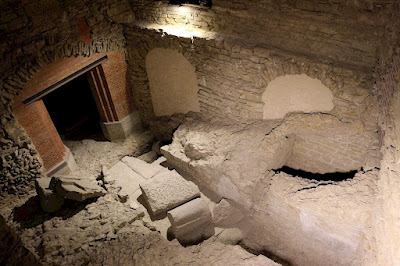
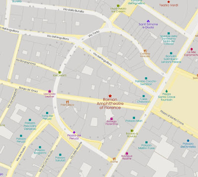
Between Piazza della Signoria and Piazza Santa Croce there is a curiously curved street, via Torta, which originated as part of the perimeter of the Roman amphitheatre. The latter had a diameter of 125 m, with a capacity of 20,000 seats. It was built in the 130 AD outside the walls and marked the point of maximum expansion of the town to the east. More of the outline of the amphitheatre is preserved in the curved Piazza dei Peruzzi.
During the rule of the Emperor Hadrian, Florentia was enlarged, and by the 3 C it was a successful commercial centre. In 287, it became the capital of the region Tuscia et Umbria, and in 405 it was able to withstand the sieges of the Ostrogoths.
More complete Roman (and Etruscan) ruins can be visited in Fiesole where there were Roman baths and a Roman theatre.
|
Author: Anna Maria Baldini


